For travellers planning a Queensland trip, this guide explains how the state’s regions differ in distance, access and the type of journey they suit.
Queensland regions and travel distances
Queensland covers more than 1.72 million square kilometres, making it Australia’s second-largest state. Its coastline runs for more than 6,000 kilometres. Across that distance, the landscape ranges from coastal cities and beach towns to farming districts, mountain ranges, sandstone gorges and remote western towns.
The Queensland Audit Office defines “regions” as all of Queensland outside Greater Brisbane. This area covers about 99 per cent of the state’s land and includes populated coastal centres as well as sparsely settled inland districts.
Regional boundaries vary by purpose. Government agencies draw them for planning, public services and statistics, while tourism bodies group places into visitor destinations. “Central Queensland,” for example, can mean different areas on different maps. Queensland Country Tourism places the Granite Belt, Toowoomba, the Lockyer Valley and the Central Queensland Highlands within its broader Queensland Country region.
Broad labels also conceal large differences in travel conditions. Toowoomba sits on the Great Dividing Range, while the Granite Belt around Stanthorpe has higher elevations, vineyards and orchards. Farther west, Carnarvon Gorge cuts through sandstone country. Longreach and Winton lie in the outback, where towns are farther apart and services between them are limited. Route maps matter, but driving time, road conditions and the distance between fuel stops shape an inland trip.
Brisbane and the south-east coast
Brisbane, Queensland’s capital, is the main gateway to the south-east. Its riverfront precincts, cultural venues, dining and outdoor spaces make it a useful base before travelling to the coast or hinterland. The Queensland tourism guide lists current activities in Brisbane and elsewhere in the state.
South of Brisbane, the Gold Coast combines surf beaches, urban centres and a forested hinterland. North of Brisbane, the Sunshine Coast has beaches, coastal towns and access to inland ranges and hinterland communities. Both work well as additions to a Brisbane stay, although holiday traffic and busy weekends lengthen driving times.
The Fraser Coast and K’gari extend a south-east coastal route farther north. Hervey Bay is a common mainland departure point for K’gari, a World Heritage-listed sand island in Great Sandy National Park. Vehicle permits, barge transfers and beach-driving conditions need separate planning. Queensland Parks and Wildlife Service park alerts list current closures and access conditions.
Road journeys in south-east Queensland are shorter than those elsewhere in the state, but holiday traffic and road incidents still affect travel times, as does rainfall. QLDTraffic reports current road conditions, while the Bureau of Meteorology publishes local forecasts. Seasonal patterns help choose a time of year, but they do not confirm current rainfall, surf conditions or park access.
Rainforests near the coast
The ranges inland from the Gold Coast have rainforest walks in Lamington and Springbrook national parks. The parks also have waterfalls and lookouts. These parks form part of the Gondwana Rainforests of Australia, a World Heritage property that includes reserves in south-east Queensland and north-east New South Wales. UNESCO describes the property as protecting rainforest and threatened species across this cross-border area.
Queensland’s section includes parts of parks and reserves across the region. The Queensland Government’s Gondwana Rainforests information identifies the included areas. The listing covers selected reserves, not every forest or national park in south-east Queensland.
Central Queensland coast and islands
Hervey Bay is both a coastal destination and a mainland base for K’gari. Farther north, Agnes Water and the Town of 1770 provide access to the southern Great Barrier Reef. They are separate stops along a long stretch of coast. Each has its own beaches and accommodation, and both offer tour departures.
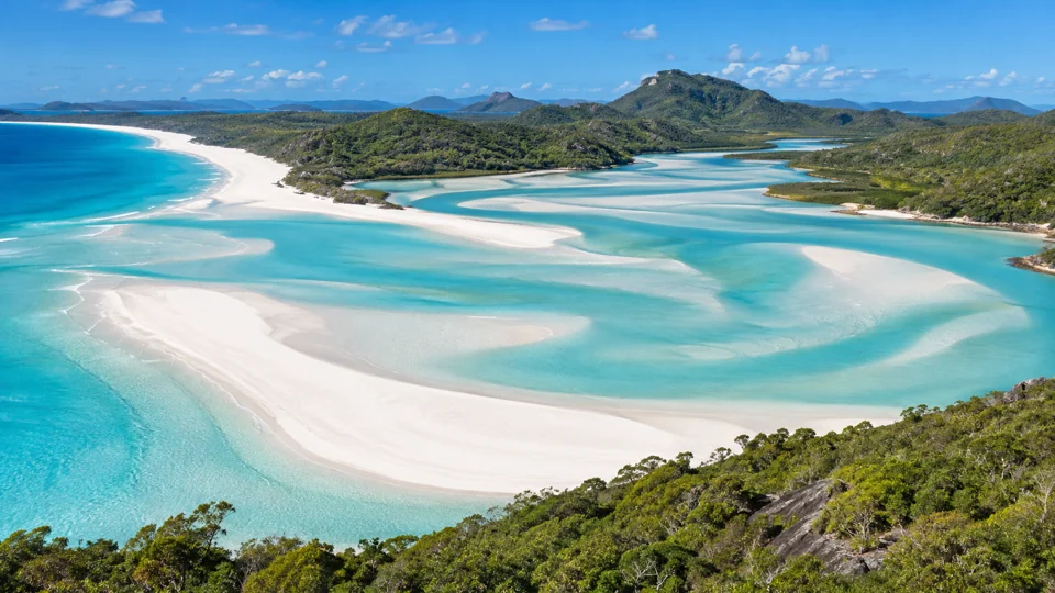
Airlie Beach is the main mainland departure point for the Whitsunday Islands, including Whitehaven Beach. The wider Whitsundays area also includes mainland communities, island resorts and sailing routes.
Whitsundays and the Great Barrier Reef
The Whitsundays lie within the larger Great Barrier Reef Marine Park. The reef extends along much of Queensland’s coast, so it is not reached from one town alone. Trips from Airlie Beach, Townsville and Cairns visit different reefs, islands and pontoons. The Great Barrier Reef Marine Park Authority’s visitor information explains marine park rules and current access requirements.
Farther north, Mackay is a coastal city with an airport and port, and it provides services for the surrounding district. It is also a route to Eungella National Park inland, where visitors walk rainforest tracks and look for platypus. Rockhampton, on the Fitzroy River, is a regional city and service centre for central Queensland. It lies inland from the coast; Yeppoon on the Capricorn Coast is the usual base for beaches and trips to Great Keppel Island.
Queensland’s official tourism guide provides a broader overview of coastal destinations and reef experiences across the state.
Tropical North Queensland and the reef
Cairns is a main gateway to the Great Barrier Reef and the Wet Tropics. Reef trips leave from the coast, while rainforest visits involve roads, tracks and park sites inland and north of the city. Cairns Airport is about 7 kilometres from the central business district, according to Cairns Airport.
Cairns and the Wet Tropics
The Wet Tropics extends along Queensland’s north-east coast from around Townsville to Cooktown. Its World Heritage Area includes rainforest, mountains, waterfalls and tablelands across a large area. The Wet Tropics Management Authority maps the region and its destinations.
The Daintree, north of Cairns, is a well-known rainforest destination where the forest meets the coast. Track closures, road conditions and park access vary by location.
Port Douglas is a smaller coastal base north of Cairns, with reef-trip departures and access to nearby rainforest areas. Farther south, Townsville is a major northern city and another mainland base for the Great Barrier Reef. Ferries connect Townsville with Magnetic Island, where beaches and walking tracks lie within Magnetic Island National Park.
Further north to Cape York
Cape York Peninsula requires more preparation than a stay in Cairns, Port Douglas or Townsville. Distances are long, and services outside towns are limited. In the wet season, weather closes roads and restricts access.
Current road and park reports determine whether a planned Cape York route is open. Seasonal advice helps with timing, but it does not confirm conditions on a particular road, river crossing or park site.
Choose Cairns, Port Douglas or Townsville based on the reef and rainforest areas you plan to visit. Inland and Cape York routes need more time and preparation than a coastal stay.