Darwin, the capital of the Northern Territory, has a wet season from roughly November to April and a dry season from roughly May to October, according to Tourism Australia. The wet season is hot, humid and stormy, and brings about 93 per cent of the year’s rain. The dry season is warm and sunny, with cool nights. The NT Government sets cyclone season from 1 November to 30 April, which falls within the wet season.
The Larrakia people, the Traditional Owners of the Darwin region, track the year through seven seasons, read from plants, animals and weather. They shared that knowledge with CSIRO as a calendar, under strict conditions on reuse. Below, the calendar is explained: who shared it, how it works, why it does not predict dates, and what permission is needed to use it.
Wet and dry season dates in Darwin
Tourism Australia puts the wet season at November to April and the dry at May to October. The edges of each season are gradual. Darwin’s local climate includes a period residents call "the build up", when temperature and humidity climb before the rain arrives. The wet season typically arrives in late November to early December, with monsoonal downpours, lightning and increased cyclone activity.
Why Darwin has two seasons
The Climate of Australia entry describes two drivers. In the Australian summer, the Intertropical Convergence Zone, a band of rising moist air near the equator, moves south and brings the Australian monsoon to parts of northern Australia. In winter, the subtropical high, a belt of sinking dry air, moves north, which produces dry winters across the north. Darwin therefore alternates between a monsoon season and a dry season.
Temperature and humidity
Temperatures change less between seasons than humidity does. Tourism Australia gives these averages:
| Season | Average temperature | Humidity |
|---|---|---|
| Wet (November to April) | 24.7 to 32 °C | Can exceed 80% |
| Dry (May to October) | 21.6 to 31.8 °C | About 60 to 65% |
Daytime maximums are almost identical across the year. The wet feels harder because of humidity above 80 per cent, which slows sweat evaporation and makes the heat more draining. The dry gives noticeably cooler nights at the bottom of its range.
The sea stays warm all year. Climate-data.org lists an annual average water temperature of about 28.8 °C in the Timor Sea, with a December peak of 31.1 °C and a low in July.
Rainfall month by month
The monthly averages below are from Tourism Australia’s Darwin weather page:
| Month | Rainfall (mm) | Month | Rainfall (mm) |
|---|---|---|---|
| January | 426 | July | 1 |
| February | 376 | August | 5 |
| March | 318 | September | 16 |
| April | 102 | October | 70 |
| May | 21 | November | 140 |
| June | 2 | December | 252 |
The annual average is 1,732.4 mm. November to April delivers about 1,622 mm of that, and May to October delivers about 114 mm. January is the wettest month, and January to March carries the heaviest falls. June, July and August are close to rainless, with 8 mm between them.
What the wet season feels like
The build-up comes first, through October and November. October’s 70 mm and November’s 140 mm show the rain starting before the official wet season, but the main change is in the air: heat and humidity rise and storms gather in the afternoons. From late November or December the monsoon settles in, with heavy downpours and frequent lightning.
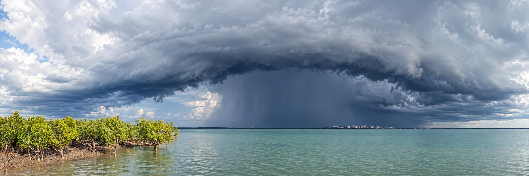
Daylight sunshine drops in the middle of the wet. Climate-data.org gives about 8 hours of sunshine a day in January and February, compared with about 10 hours from April to August and in October and November. Rain tends to arrive in bursts rather than as constant grey days, so plans in the wet work best when they are flexible and built around the weather of the day.
The wet season has two practical hazards: cyclones and floods. Both are covered below, and both affect travel plans well beyond Darwin’s suburbs.
What the dry season feels like
The dry season is the period most visitors picture. Skies are clear and days are warm and sunny, with mild sea breezes from the harbour. Nights are cooler, humidity falls to about 60 to 65 per cent, and rain is rare from May through September. Sunshine runs to about 10 hours a day from April to August.
Because the dry is the easier season for outdoor activity and for travel on unsealed roads, it is also the busier one for visitors. Anyone who wants to see Darwin at its most comfortable should plan for May to September. October starts to turn humid and sticks closer to the build-up than to the dry.
Cyclone season
The NT Police, Fire and Emergency Services (PFES) gives the official cyclone season as 1 November to 30 April, and notes that cyclonic events have occurred outside that period. PFES says two to three cyclones affect the Top End each season, a figure the Territory Insurance Office severe weather guide for 2024 repeats. Cyclones usually affect coastal areas up to 50 km inland.
NT Tourism rates cyclones from category 1, the least severe, to category 5, the most severe. They last from a few days to a few weeks, and storm surges and heavy rain flood low-lying coastal areas.
Darwin’s history shapes how seriously residents treat the season. The National Archives of Australia lists the worst Darwin cyclones as those of 1897, 1937 and 1974. Cyclone Tracy hit in December 1974 as a category 4 cyclone.
A recent event shows the season can start early. The City of Darwin records that Cyclone Fina made landfall on 22 November 2025, the earliest cyclone landfall on the NT coast since records began and the most intense to hit Darwin since Tracy. The City declared its response officially complete on 30 April 2026, and says a record-breaking wet season that followed hindered recovery.
Seasons vary. In December 2023, the Bureau of Meteorology forecast a below-average number of tropical cyclones for Australia that season and average or below-average NT rainfall, with a later monsoon onset leaving fewer months for cyclones to develop. That outlook applied to one season only, and the more recent season went the other way.
Cyclone warnings and preparation
The Bureau of Meteorology’s Tropical Cyclone Warning Centre issues Tropical Cyclone Advices, which are broadcast on radio and television, as the Darwin Airport cyclone plan describes. The TIO guide describes warning stages called Advice (Yellow) and Watch and Act (Orange), with a more urgent level above those. When a cyclone is about 6 to 12 hours away and still expected to hit, the Standard Emergency Warning Signal (SEWS) sounds before the cyclone advice on radio and television. ABC Darwin on 105.7 FM is the official emergency broadcaster.
For emergencies, call Triple Zero (000) when life is at risk. For help during floods, storms and cyclones, the NT Emergency Service lists 132 500.
NT Tourism advises everyone in the Territory, including visitors, to have a cyclone emergency plan and to check the plan at their accommodation. The practical steps are:
- Confirm that your accommodation is built to cyclone-resistant codes. If it is not, arrange to shelter with friends, family or in a public shelter.
- Ask for advice on tying down and securing a vehicle or caravan.
- Keep a battery radio, torch, spare batteries, food and water, and identify safe routes to shelter.
- If a cyclone approaches, turn off power, gas and water, disconnect electrical appliances, shelter in the strongest part of the building and keep a portable radio on for updates.
Residents of low-lying coastal areas should know their storm surge risk and be ready to move to higher ground when authorities advise. Pets are not allowed in Darwin emergency shelters, although some undercover car parks admit properly restrained pets. The National Emergency Management Agency adds that severe storms occur more often than any other natural hazard in the NT, so the preparation applies to ordinary wet-season storms as well as cyclones.
Floods and road closures
Flooding closes roads every wet season, and the 2026 season was severe. On 11 March 2026, Big Rigs reported that the Bureau described the rainfall as "uncommonly heavy", with closures on the Stuart and Victoria Highways and patching on Cox Peninsula Road. By 24 March, several sections of the Stuart Highway had shut again from flood damage, and an ex-cyclone marked the seventh event of that wet season.
By 27 March, the NT Government’s Road Report showed 76 territory roads closed, 26 impassable and 66 with surface hazards, including the Arnhem Highway. The Minister called the damage unprecedented. These numbers cover the whole Territory rather than Darwin alone, but they show how far a heavy wet reaches beyond the city, especially for anyone driving to Kakadu, Katherine or Arnhem Land.
Remote routes are more exposed. Central Arnhem Road is prone to flooding from December to April, with frequent restrictions for heavy vehicles and infrequent closures, and four-wheel drive is recommended.
NT Tourism’s road safety advice is to expect closures in the wet season, never travel on a closed road because heavy fines may apply, and check conditions daily because they change quickly. The live source is the Road Report NT.
Who shared the Larrakia calendar
The Larrakia calendar came from members of the Gulumoerrgin language group. CSIRO describes Gulumoerrgin as the Indigenous language name for Darwin and the surrounding Cox Peninsula and Gunn Point region. Its page names Lorraine Williams, Judith Williams, Maureen Ogden, Keith Risk and Anne Risk as leading the development of the calendar, and gives 2012 as the citation date. CSIRO says it has co-designed its seasonal calendar approach with Indigenous partners over the past fifteen years.
Authority over Larrakia knowledge belongs to the Larrakia people. The Larrakia Nation Aboriginal Corporation is their legal representative.
How the calendar works
CSIRO says the Gulumoerrgin year divides into seven main seasons, and that the Western four-season calendar is not a particularly informative way of engaging with Australian weather and climate. The Conversation’s explainer describes each season as linked to distinctive weather patterns and to changes in plants, animals and human activity. Your Tropical City describes the year as marking rainfall and the availability of bush food.
Each season is recognised by what is happening in the landscape. One published example from ARRC ties the collection of magpie goose eggs to the flowering of local speargrass. The Conversation gives another: wattle flowering indicates that local stingrays are plentiful and good to eat. A sign in the bush tells people what to do next, so the calendar works as a guide to food, weather and daily life together.


The Darwin Convention Centre describes the year as having "no beginning and no end but a constant change that can be felt". The seven seasons therefore form a continuous cycle.
Why the calendar does not predict dates
The Larrakia calendar links one seasonal sign to the next and assigns no dates. A visitor cannot read it to learn whether the monsoon will arrive in late November or mid December, or whether a cyclone is coming. The calendar shows how Larrakia observation connects weather to plants, animals and activity.
For planning, use the Bureau of Meteorology for weather and cyclone advice and PFES for emergency warnings. The Larrakia calendar adds understanding of what the Darwin seasons look like on the ground and why a two-season split leaves much out.
Permission to reuse the calendar
CSIRO treats the calendars as Indigenous Cultural and Intellectual Property (ICIP) belonging to the people and communities who shared them, citing Article 31 of the United Nations Declaration on the Rights of Indigenous Peoples. Its calendars page states that the calendars have been published with the permission of their ICIP owners and with certain conditions on their use.
The terms and conditions allow educational outreach only. Users must acknowledge and properly attribute who and where the ICIP came from, and must respect it and maintain its cultural integrity. The terms prohibit:
- publishing the calendars or putting them online, including on social media;
- changing, adapting or creating derivatives of the calendars;
- commercial use, which covers selling them, using them as promotional material, implying endorsement of a product or service such as a book, app or signage, or using them for commercially focused activities or facilities.
Users must also acknowledge that using ICIP without permission, or in the wrong way, may cause harm or offence to knowledge holders, their families and communities. CSIRO’s download process asks for at least four weeks to allow for informed consent consultation, so permission requests need lead time.
For that reason, reuse beyond a reference and link to CSIRO’s page needs permission. Larrakia Nation’s protocols apply to knowledge, documents and materials, and anyone who wants to use, store or reproduce Larrakia material should contact the Larrakia Nation board for permission and guidance through its contact page. Someone planning a tour, product, sign or publication around the calendar should start there and with CSIRO before doing anything else, because commercial use falls outside what the terms permit.
Respecting Larrakia Country
The Larrakia protocols state that Larrakia are the Aboriginal owners of all land and waters of the greater Darwin and rural area, and that Aboriginal law requires respect for the cultural authority of the Aboriginal owners. They apply to Aboriginal and non-Aboriginal visitors and residents alike. A visitor would traditionally come to the Larrakia on arrival to receive a Welcome to Country. Larrakia retain traditional knowledge such as stories about significant sites, and visitors are asked to respect that.
Larrakia Nation ran an Ambassador program in the 1980s and 1990s and started a Host program in 2018, as its cultural protocols page describes. The 2012 Larrakia Declaration, made at the Pacific Asia Indigenous Tourism Conference in Darwin, states that the tourism industry will respect Indigenous intellectual property rights, cultures and traditional practices. It is a non-binding industry statement, so the protocols and CSIRO’s terms remain the working guide.
The Larrakia also hold the longest-running land claim in the Northern Territory, the Kenbi Land Claim. The court found in their favour, but land ownership has not been transferred, and the Larrakia Nation says their native title rights were controversially rejected in 2006.
Choosing when to visit
The dry season, May to October, suits first-time visitors who want sunshine, lower humidity and reliable roads. Rain is minimal from June to August, and nights are cooler. October is warmer and more humid as the build-up starts.
The wet season suits visitors who accept heat and storms in exchange for dramatic skies and fewer crowds. Plan for flexible itineraries, check accommodation cyclone arrangements, check Road Report NT daily before any drive and avoid remote routes during heavy rain. Residents planning a move should treat the wet as the main test of a household’s preparation, with a cyclone plan and emergency kit ready before 1 November.