Lamington National Park is a 21,176-hectare rainforest reserve in the Gold Coast hinterland of south-east Queensland, about 110 km (roughly two hours’ drive) south of Brisbane, according to Queensland Parks and Wildlife Service (QPWS). It was gazetted in 1915 and World Heritage-listed in 1994, and it now forms part of the Gondwana Rainforests of Australia World Heritage Area. Visitors come for waterfalls, cliff-edge lookouts, ancient trees and walking tracks that range from 30-minute strolls to eight-hour days.
First-time visitors need to settle a few things early. Green Mountains is on the western side of the park and Binna Burra is on the eastern side. Each has its own access road, so choose one as your base. Cyclone damage from 2025 still closes parts of several tracks, so check the official alert before you leave. The park’s creeks are off limits for swimming. Camping requires a permit booked before you arrive. There is no public transport, so you will need a car.
Visitor Areas, Lookouts and Swimming
Lamington protects rainforest on the McPherson Range, which runs along the Queensland and New South Wales border. QPWS says the park supports 390 species of Australian wildlife. The animals most visitors notice are Albert’s lyrebirds, which turn up along walking tracks, along with crimson rosellas, king parrots and red-necked pademelons (small forest wallabies). QPWS advises that lyrebirds are more often encountered in cooler months and that pademelons are most visible in picnic areas at dawn and dusk. Feeding wildlife is prohibited.
Green Mountains sits at roughly 935 m elevation. Its day-use area has toilets, tables and three electric barbecues, and QPWS warns that it is crowded at weekends and on holidays. QPWS suggests bringing your own seating and a fuel stove. The camping area here is now called O’Reilly’s Campground, following a revitalisation project.
Binna Burra is lower, at roughly 650 m. A lower day-use area beside the information centre has two picnic tables and toilets. An upper day-use area at the end of Binna Burra Road, next to the main trailhead, has toilets, tables and an electric barbecue. Most of the longer walks start from the upper area or from the Saddle trailhead.
Neither side has rubbish bins at picnic areas. QPWS expects you to carry out all rubbish, including food scraps and sanitary products. Commercial tours operate in the park, but QPWS does not run regular ranger-guided walks, so independent walking is the norm.
For a first trip, Green Mountains suits visitors who want a lookout and a waterfall within an hour or two of the car park and who enjoy a large, busy base. Binna Burra suits walkers who want a wider choice of long circuits, and it starts the shorter route to the Coomera Falls lookout. A two- or three-day visit can include both, since the Border Track links them on foot, though by road they are separate drives.
Lookouts come in two types. A platform lookout has a built structure with handrails, while a natural lookout has neither, so you need to stay back from the edge and keep children close.
On the Green Mountains side, QPWS lists several named viewpoints:
- Kamarun has views across about 200 degrees.
- Python Rock looks out to Morans Falls, Castle Crag and the Lost World.
- Echo Point is known for sunrise and sits near a bush camp.
- Garragoolba lookout overlooks Springbrook, the Tweed Valley and Mount Warning.
- Orchid Bower, Numinbah and Darrayabroo are further named lookouts.
At Binna Burra, the Coomera circuit leads to the Coomera Falls lookout, and both Coomera and Yarrabilgong falls are viewed from lookouts. The Araucaria lookout is on the Araucaria lookout track, and the Gwongoorool track finishes with views over the Coomera River. The park’s highest point is Mount Bithongabel at 1,199 m.
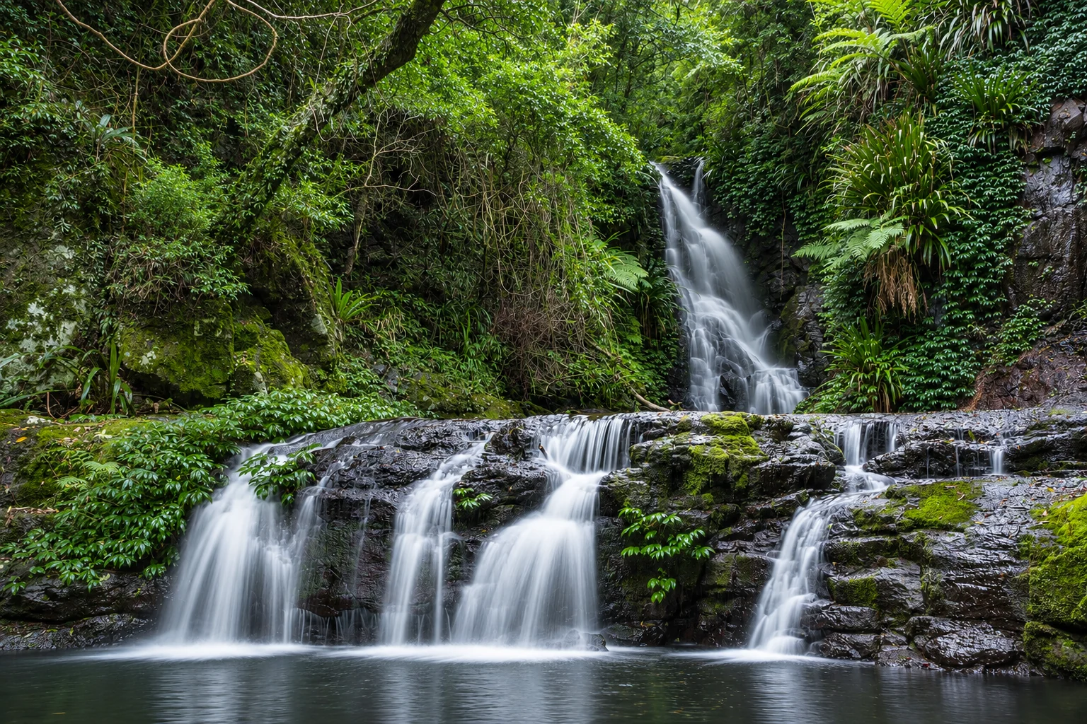
Waterfall walks that suit a first visit include Morans Falls (a 4.4 km return, Grade 4, from Green Mountains) and Elabana Falls on the Box Forest circuit. Upper Ballunjui Falls is open to walkers on a return-by-the-same-track basis under the current alert, but the Ballunjui Falls area itself is a restricted-access zone, so follow the signed route only.
Swimming is the main disappointment for visitors who expect rainforest pools. QPWS states that the park’s sensitive waterways are "not suitable for swimming" because they are habitat for several endangered and vulnerable frog species. Treat the falls and creeks as places to look at and photograph. If you want to swim after a hot walk, plan a stop on the coast or at your accommodation on the way home.
Getting There and Where to Stay
There is no public transport to the park, and QPWS notes that taxi and ride-share pickups are difficult. Plan to drive, or join a commercial tour from the Gold Coast or Brisbane.
For Green Mountains, Wikivoyage describes the route as the M1 Pacific Motorway for about 70 km from Brisbane, then Exit 69 onto State Route 20 (Southport Nerang Road) and on through Canungra. The final stretch is the slow part. According to QPWS visitor safety information, the road from Canungra is 36 km of winding, often narrow bitumen that takes at least 50 minutes. The Green Mountains day-use area sits at the end of Lamington National Park Road, 5.7 km from the park entrance, and a conventional vehicle can reach it. The park map labels this section a "no through road", so you return the way you came.
Vehicles longer than 6 m are unsuitable for the Green Mountains road, and so are vehicles towing caravans or camper trailers. If you are driving a camper trailer or an RV longer than 4 m, QPWS recommends booking accommodation that suits that vehicle.
Binna Burra is reached along Binna Burra Road, and the upper day-use area and trailhead are 3.5 km from the entrance. Allow more driving time than the 110 km figure suggests, because both approaches climb into the hills on narrow, curving roads.
Vehicle entry to the park is free; seniortravel.au names Lamington as an example of a Queensland national park reached without a fee gate. You need no day-use pass, and the only payments are for camping and for any commercial tour or lodge you choose. Camping without a permit carries an on-the-spot fine, which Pack and Pitch reports as $322.
Three areas are declared restricted access to protect rare and threatened species and sensitive habitat: Ballunjui Falls, Black Canyon and Coomera Gorge. QPWS prohibits unauthorised entry to these areas, and a restricted-access declaration also covers the Poondahra cliffs area near Binna Burra.
Two ecolodges adjoin the park: O’Reilly’s Rainforest Retreat and Binna Burra Mountain Lodge, one beside each visitor area. Binna Burra Lodge was built next to the park in the 1930s by the National Parks Association of Queensland, as Wikipedia records. Staying at either lodge puts you at a trailhead in the morning, which matters when the long walks take seven or eight hours.
Holiday accommodation is also available in and around Canungra, Beechmont and other Gold Coast hinterland towns. Canungra is the gateway town for the Green Mountains road, so it makes a practical base if you want to start early without paying lodge prices.
Other options sit on the park’s edges. Lamington Eco is a 160-acre property on Christmas Creek with two accommodation options. Cedar Glen Farmstay, about half an hour’s drive from Beaudesert, lists camping from $50 per person per night and cottages from $385 per night. Tripadvisor shows accommodation near the park from AU$125, with average nightly rates of $144 in December to February and $138 in March to May. Book early for weekends and school holidays, and check the vehicle limits above if you are towing or driving a long RV.
Walks by Distance and Difficulty
QPWS grades tracks using the Australian Walking Track Grading System, which runs from Grade 1 (flat, even surface, wheelchair-suitable with assistance) to Grade 5. A track takes the grade of its hardest section, so parts of a Grade 4 walk may be easier. Grade 2 is a formed track that may have gentle hills and some steps, and it needs no previous bushwalking experience, per the Green Mountains map. The walking tracks summary recommends ankle-supporting footwear and suggests allowing 15 to 20 minutes per kilometre for average fitness. Allow more time with children or less-fit walkers.
Short walks
| Walk | Area | Grade | Return distance | Time |
|---|---|---|---|---|
| Centenary track | Green Mountains | 1 | 1.8 km | 30 min |
| Rainforest return | Green Mountains | 2 | 1.4 km | 30 min |
| Python Rock track | Green Mountains | 3 | 3.1 km | 1 hr |
| Morans Falls track | Green Mountains | 4 | 4.4 km | 1.5 hr |
| Rainforest circuit | Binna Burra | 2 | 1.2 km | 30 min |
| Tullawallal circuit | Binna Burra | 3 | 5 km | 1.5 hr |
| Gwongoorool track | Binna Burra | 4 | 6 km | 2 hr |
| Caves track | Binna Burra | 4 | 7 km | 2 hr |
The Centenary track is the easiest option in the park. QPWS describes it as suitable for everyone regardless of ability. It starts at the Python Rock and Morans Falls trailhead. Python Rock and Morans Falls both end at platform lookouts, which are built viewing structures with handrails. The Gwongoorool track starts at the lower picnic area and ends with views of the Coomera River.
Full-day walks
| Walk | Area | Grade | Distance | Time |
|---|---|---|---|---|
| Box Forest circuit | Green Mountains | 4 | 10.9 km | 4 hr |
| West Canungra Creek circuit | Green Mountains | 4 | 13.9 km | 5.5 hr |
| Toolona Creek circuit | Green Mountains | 4 | 17.4 km | 6 hr |
| Albert River circuit | Green Mountains | 4 | 21.8 km | 7 hr |
| Border Track (one way) | Between areas | 4 | 21.4 km | 7 hr |
| Lower Bellbird track | Binna Burra | 4 | 10 km | 3.5 hr |
| Daves Creek circuit | Binna Burra | 4 | 12 km | 4 hr |
| Coomera circuit | Binna Burra | 4 | 17.4 km | 7 hr |
| Araucaria lookout track | Binna Burra | 4 | 17.8 km | 7 hr |
| Wagawn track | Binna Burra | 4 | 18 km | 8 hr |
| Mount Hobwee circuit | Binna Burra | 4 | 18.2 km | 8 hr |
| Ships Stern circuit | Binna Burra | 4 | 21 km | 8 hr |
| Illinbah circuit | Binna Burra | 5 | 16.6 km | 8 hr |
Almost every full-day walk is Grade 4, and the Illinbah circuit is the only Grade 5 track listed. For a first visit, the Box Forest circuit is the most approachable full-day option, since it leads to Picnic Rock and Elabana Falls. At Binna Burra, the Lower Bellbird track and the Daves Creek circuit are the shortest full-day walks. The Border Track is described by QPWS as the "backbone" of the track system. Because it is a one-way 21.4 km walk between the two visitor areas, it requires a plan for getting back to your car.
Multi-day and remote walking
The Gold Coast Hinterland Great Walk covers 54 km between Lamington and Springbrook national parks via the Numinbah Valley and takes about three days. QPWS recommends walking west to east, from Green Mountains (O’Reilly’s) to The Settlement camping area in Springbrook National Park. The first leg is the Border Track to Binna Burra, and the second is 23.6 km from Binna Burra to the Woonoongoora walkers’ camp (Grade 4, about 6 to 8 hours).
Remote bushwalking away from marked tracks needs high fitness and navigation skills. QPWS advises remote-area walking only in cooler weather, usually April to September, because summer heat and a lack of surface water make it very hazardous. Contact QPWS for route advice before you set out.
Closures, Alerts and When to Go
Damage from Tropical Cyclone Alfred still affects the tracks. Park alert 25025, titled Severe Weather Damage, applies from 14 March 2025 to 31 December 2026 and was last updated on 14 May 2026. It also covers the Gold Coast Hinterland Great Walk. Some areas stay closed until rangers declare them safe. The Park Alerts page lists temporary closures, fire prohibitions and prescribed burns, and it is worth checking again the day before you travel.
As of the 14 May 2026 update, three sections are closed or restricted. On the Illinbah circuit, the eastern side is closed from the first junction on the Gwongoorool track to the Illinbah bush camp, and the western side is open from the second Gwongoorool junction. On the Coomera circuit, the stretch from the Coomera Falls lookout to the southern Border Track junction is closed, so you can reach the lookout only from the northern junction and must return the same way. On the Albert River circuit, the section from the northern Border Track junction to Echo Point is closed, so Echo Point is reachable only from the southern junction, again as an out-and-back walk.
The same alert lists as open the Border Track between Binna Burra and O’Reilly’s, the Great Walk track, the Binna Burra upper day-use area and trailhead toilets, and most Binna Burra circuits: Rainforest, Tullawallal, Caves, Gwongoorool, Daves Creek, Lower Bellbird, Wagawn, Araucaria, Mount Hobwee and Ships Stern. Older closure notices on other QPWS pages show an earlier end date of 31 October 2025. Alert 25025 replaces them.
The Albert River and Coomera circuits are only partly open, so the distances in the walk tables above do not apply to them at the moment. Plan these as out-and-back walks to the open lookouts. If you reach a closure at a trailhead, follow the signs and turn back rather than going around barriers. Rangers have not confirmed closed sections as safe, and storm damage can hide hazards that you cannot see from the track.
For seasons, the cooler months from April to September suit long and remote walks. Summer is hot and humid, and QPWS warns that high temperatures make remote walking hazardous. Remote bush camping areas are open between 1 February and 30 November each year. Weekends and public and school holidays are the busiest times, especially at Green Mountains. Arrive early to get a parking space and a free picnic table.
Camping, Permits and Fees
Every camper needs a permit, and you must book and pay before arriving at a camping area. QPWS camping bookings are mostly made online through the Queensland National Parks Booking Service, which emails the permit. You can also book over the counter at a booking office or by phoning 13 QGOV (13 74 68), though mobile charges may apply.
QPWS advises booking at least six weeks ahead for popular spots, especially during public and school holidays. Bookings open well in advance. Once you start camping, display the camping tag, or a paper alternative showing the permit number, area, dates, number of people, surname and vehicle registration, on your tent, vehicle or equipment. Rangers check for this tag, so keep the permit number handy even if you have booked online.
Permits are charged per person per night. From 1 July 2026 the rate is $7.75 per person or $31 per family per night. The official booking page that was retrieved still shows the earlier rates of $7.50 per person and $30 per family, so confirm the amount at checkout. A family means one or two adults plus accompanying children under 18, up to eight people in total, and children under five camp free. Students and accompanying adults on approved educational excursions pay $4.25 per person per night.
For a worked example, a family of four camping for two nights pays one family rate per night. At the 1 July 2026 rate, that is $62 for the two nights, or $60 at the earlier rate shown on the booking page. The family rate applies only to a family as defined above. A group of four unrelated adults pays the per-person rate instead.
Two developed camping options sit at the park’s edges. O’Reilly’s Campground at Green Mountains has 24 campsites, four bushwalker sites and 15 powered and unpowered sites for campervans and camper trailers. Tourism listings show campsites from $27 per night and unpowered campervan sites from $40. The Rainforest Campsite at Binna Burra Lodge lists swag sites from $25, unpowered tent sites from $30, and powered campervan sites from $35 for vehicles up to 6.5 m. It has showers, toilets, a communal kitchen, a fire pit and laundry. Confirm these prices directly before booking, since operators set them.

Remote bush camping needs a permit, advance booking and a fee. Sites include spots on the Darlington Range, in high-altitude rainforest and on the escarpment. Tracks to the Illinbah bush camp and near Echo Point lead to bush camps, though the current alert affects both routes. Check the alert before you choose a remote site. Bring your own water and food, and carry out your rubbish, because the park has no bins at remote camps.